Tropical Weather Outlook
NWS National Hurricane Center Miami FL
800 AM EDT Wed Aug 28 2024
For the North Atlantic…Caribbean Sea and the Gulf of Mexico:
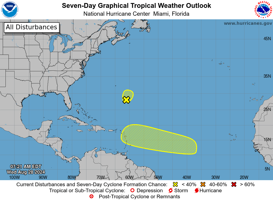
Western Atlantic:
WHAT’S APP GROUP LINK
An area of low pressure located a few hundred miles southeast of Bermuda is producing a small area of disorganized shower and
thunderstorm activity.
Dry air and strong upper-level winds are expected to limit additional development of this system during the
next day or so while the low moves northward to north-northeastward at around 10 mph.

* Formation chance through 48 hours…low…10 percent.
* Formation chance through 7 days…low…10 percent.
WHAT’S APP GROUP LINK
Central Tropical Atlantic:
An area of low pressure could form in the central portion of the Tropical Atlantic in a few days.
Thereafter, environmental conditions appear generally favorable for some slow development of
the system this weekend into early next week while it moves westward to west-northwestward at 10 to 15 mph.
* Formation chance through 48 hours…low…near 0 percent.
* Formation chance through 7 days…low…20 percent.
Forecaster Reinhart
Advertise with the mоѕt vіѕіtеd nеwѕ ѕіtе іn Antigua!
We offer fully customizable and flexible digital marketing packages.
Contact us at [email protected]


