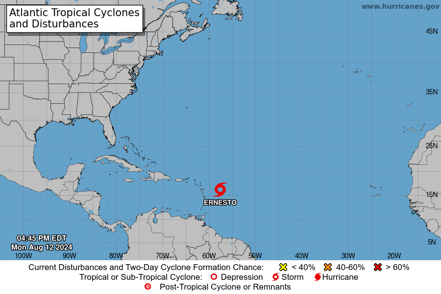
Tropical Storm Ernesto Advisory

Location and Movement:
As of 5:00 PM AST (2100 UTC), the center of Tropical Storm Ernesto is positioned at latitude 16.0 North, longitude 57.5 West. Ernesto is moving west-northwest at approximately 28 mph (44 km/h).
A slight decrease in speed is anticipated over the next couple of days as the storm tracks westward to west-northwestward. Ernesto is expected to pass over portions of the Leeward Islands late tonight or Tuesday and approach the U.S. and British Virgin Islands and Puerto Rico by Tuesday evening. Following this, the storm is forecast to turn northward over the western Atlantic.

Winds:
Maximum sustained winds are near 40 mph (65 km/h) with higher gusts. Gradual strengthening is anticipated over the next few days. Tropical-storm-force winds extend outward up to 60 miles (95 km) from the center.
Pressure:
The estimated minimum central pressure is 1009 mb (29.80 inches).

Hazards Affecting Land:
Rainfall:
Ernesto is expected to bring heavy rainfall to the region. The Leeward and Virgin Islands may receive 4 to 6 inches of rain, while Puerto Rico could see 3 to 6 inches, with isolated areas receiving up to 10 inches. The Windward Islands may get 1 to 4 inches, and eastern Hispaniola could see 2 to 4 inches of rain through Friday morning.
Wind:
Tropical storm conditions are expected to reach the Leeward Islands late tonight or early Tuesday, spreading to the Virgin Islands and Puerto Rico by Tuesday evening.
Storm Surge:
A storm surge of 1 to 3 feet above ground level is expected along the eastern coast of Puerto Rico, including the islands of Culebra and Vieques, and in the U.S. Virgin Islands, including St. Thomas, St. John, and St. Croix. The British Virgin Islands could also see a surge of 1 to 3 feet above normal tide levels, accompanied by large and destructive waves.
Surf:
Swells generated by Ernesto are expected to impact portions of the Leeward Islands starting late tonight, potentially causing life-threatening surf and rip current conditions. Residents are advised to consult local weather advisories for more details.
Additional Information:
For further details and key messages on Tropical Storm Ernesto, refer to the Tropical Cyclone Discussion under AWIPS header MIATCDAT5 and WMO header WTNT45 KNHC, available at hurricanes.gov.
For a complete depiction of forecast rainfall, visit the National Weather Service Storm Total Rainfall Graphic at hurricanes.gov/graphics_at5.shtml?rainqpf.
Advertise with the mоѕt vіѕіtеd nеwѕ ѕіtе іn Antigua!
We offer fully customizable and flexible digital marketing packages.
Contact us at [email protected]


