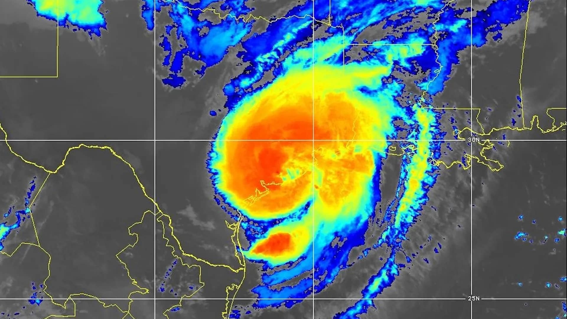
AccuWeather expert meteorologists say the threat of flash flooding and tornadoes will expand throughout the day as Beryl moves inland.

Beryl made landfall as a Category 1 hurricane with maximum sustained winds of 80 mph near Matagorda, Texas early Monday morning.
“Beryl has been a resilient storm ever since it exploded into a Category 5 hurricane in the Caribbean last week and devastated communities in the Windward Islands,” said AccuWeather Lead Hurricane Expert Alex DaSilva. “People in the path of Beryl’s track should not let their guard down this week. Beryl will bring the risk of tornadoes as far away as Ohio. Downpours from Beryl could also cause flash flooding as far north as Detroit, more than 1,100 miles from where Beryl made landfall in Texas.”

The powerful winds and rough surf from Beryl pushed several feet of storm surge into coastal areas Monday morning, flooding roads and blocking access to several communities along the Texas shoreline.
“These strong winds will down trees and cause power outages and significant property damage. Power outages can last for days to weeks in the hardest-hit areas,” said AccuWeather Senior Meteorologist Tyler Roys. “The most intense rainfall, ranging from 8 to 12 inches in most areas, will occur near the storm’s landfall location along the east-central Texas coast, extending up to Houston and Tyler.”
The wind from Beryl knocked out power to more than 2 million homes and businesses in southeastern Texas Monday morning. After wind and rain impacts subside as the storm pulls away, AccuWeather expert meteorologists encourage people who lost power to stay hydrated and use extra caution operating generators to try to stay cool. Improper use of generators after storms can lead to carbon monoxide poisoning, electrocution and even fires.
AccuWeather RealFeel® high temperatures are forecast to top 100 degrees later this week in Galveston, Bay City, and Port Lavaca, Texas.
“The heat can be dangerous for people who do not have power as they work to clean up debris and repair storm damage. Heat exhaustion and even heat stroke can set in quickly if people don’t have a place to cool down. Everyone dealing with the Texas heat who lost power needs to have access to shaded areas and drink plenty of water to stay hydrated,” said AccuWeather Chief Meteorologist Jon Porter. “People understandably get desperate for power when those outages last days or weeks. We’ve seen tragic cases of people being hurt or killed when they try to use portable generators after a hurricane landfall. It’s crucial for people to use extreme caution when operating generators and make sure there is proper ventilation away from doors and windows to your home.”
Wind gusts from Beryl could also impact high-rise buildings in downtown Houston where repairs are still underway after a derecho in May blew out hundreds of windows.
“Wind gusts above 80 mph could compromise windows and cause more damage to buildings in Houston that were hit hard by the derecho this spring,” said Porter.
Multiple tornado warnings were issued in the Houston area early Monday morning as Beryl made landfall. DaSilva said the tornado threat will shift farther inland over the next 48 hours.
“The Houston area faces a tornado threat through the early-afternoon hours. The risk of tornadoes will expand to the northeast following the eastern side of the storm track. The tornado threat extends as far northeast as Cincinnati, Ohio, tomorrow,” said DaSilva. “Tornadoes embedded in rain bands from hurricanes and tropical storms can spin up quickly and are incredibly dangerous.”
Beryl strengthened in the warm waters of the Gulf of Mexico late Sunday night from a tropical storm to a Category 1 hurricane with maximum sustained winds of 74-95 miles per hour on the Saffir-Simpson Hurricane Wind Scale. DaSilva said it will take only a week or two for sea surface temperatures to rebound in the wake of Beryl, raising the risk for more tropical threats in the Gulf of Mexico.
“We’ve been concerned about this hurricane season and the risk to the Texas coast since AccuWeather issued its first forecast in March. Water temperatures across much of the Gulf of Mexico are essentially as warm as bathtub water. Those warm waters are at the surface, and they extend hundreds of feet down. Warm waters act like jet fuel for hurricanes, and it won’t take long for temperatures to rebound in the wake of Beryl,” said DaSilva. “We’ll be keeping a very close eye on the Gulf of Mexico and the Texas coast for more tropical threats this summer. AccuWeather is forecasting 20 to 25 named storms and four to six direct impacts on the United States this season.”
AccuWeather expert meteorologists also encourage people to use caution at beaches along the Gulf Coast through Monday evening. Swells from Beryl could create dangerous rip currents as far away as southwestern Florida.
AccuWeather Forecast Graphics:


Advertise with the mоѕt vіѕіtеd nеwѕ ѕіtе іn Antigua!
We offer fully customizable and flexible digital marketing packages.
Contact us at [email protected]


