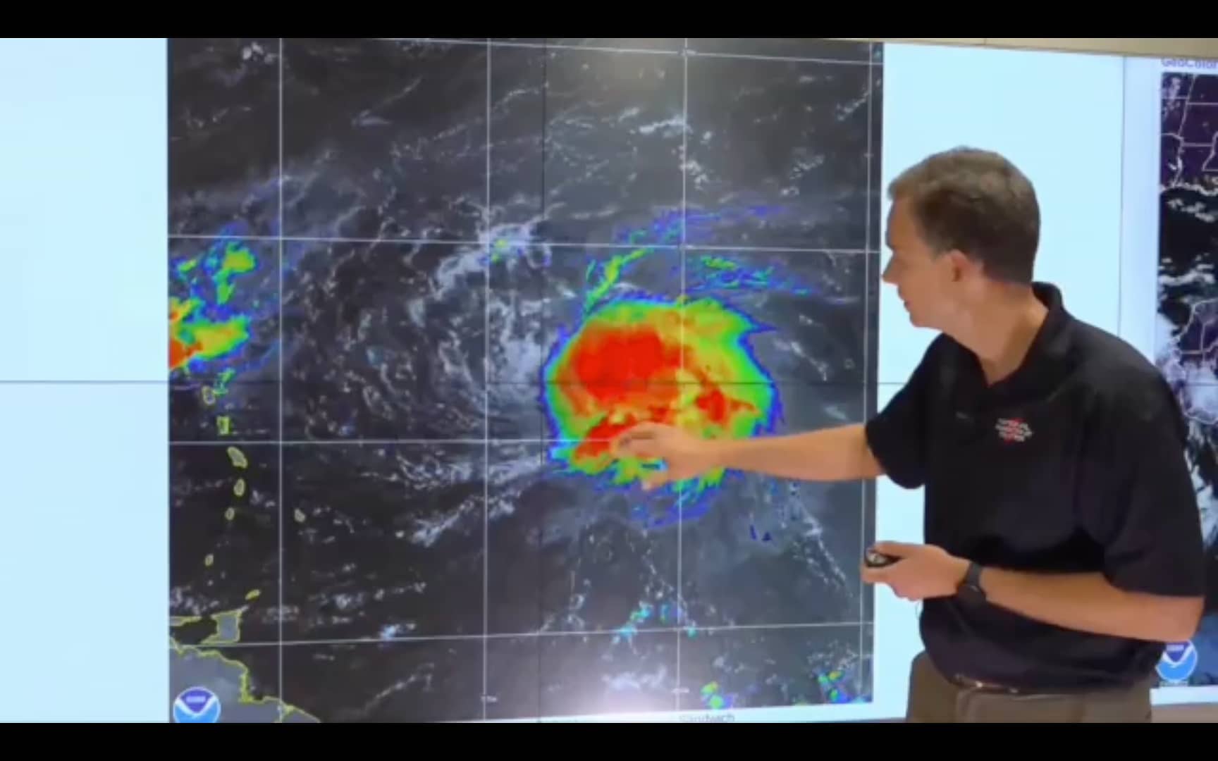
At 500 PM AST (2100 UTC), the center of Tropical Storm Fiona was about 425 miles east of the Leeward Islands.
Fiona is moving toward the west near 14 mph (22 km/h). A westward motion with some decrease in forward speed is expected through Saturday night, with a turn toward the west-northwest possible on Sunday.
On the forecast track, the center of Fiona is expected to move across the Leeward Islands Friday night and early Saturday, and move near the Virgin Islands and Puerto Rico late Saturday into Sunday.
Data from an Air Force Reserve Hurricane Hunter aircraft indicate that maximum sustained winds are near 60 mph (95 km/h) with higher gusts. Little change in strength is forecast during the next few days.
Tropical-storm-force winds extend outward up to 140 miles (220 km) mainly to the north of the center.
The minimum central pressure based on data from the reconnaissance aircraft is 1006 mb (29.71 inches).
WIND: Tropical storm conditions are expected across portions of the northern Leeward Islands within the warning area beginning Friday evening.
Tropical storm conditions are possible within the watch area across the Virgin Islands on Saturday, and reaching Puerto Rico late Saturday or Saturday night.
RAINFALL: Fiona is expected to produce the following rainfall totals:
Northern Leeward Islands, the British and U.S. Virgin Islands and Puerto Rico: 4 to 6 inches with isolated maximum totals of 10 inches across eastern Puerto Rico.
Eastern Hispaniola: 4 to 8 inches with isolated maximum totals of 12 inches.
These rains may produce flash and urban flooding, along with isolated mudslides in areas of higher terrain. Considerable flood impacts are possible across eastern portions of Puerto Rico.
STORM SURGE: Localized coastal flooding will be possible along the coasts of the U.S. Virgin Islands and Puerto Rico in areas of onshore winds Saturday into Sunday.
SURF: Swells generated by Fiona are beginning to affect the Leeward Islands and will spread westward to the Virgin Islands and Puerto Rico on Friday and Saturday.
These swells could cause life-threatening surf and rip current conditions. Please consult products from your local weather office.
Next complete advisory at 1100 PM AST.
Advertise with the mоѕt vіѕіtеd nеwѕ ѕіtе іn Antigua!
We offer fully customizable and flexible digital marketing packages.
Contact us at [email protected]


sum body teach dah dude de rye pronunciation no bai
Hopefully Fiona will bring some beneficial rain and no damage.
Comments are closed.