


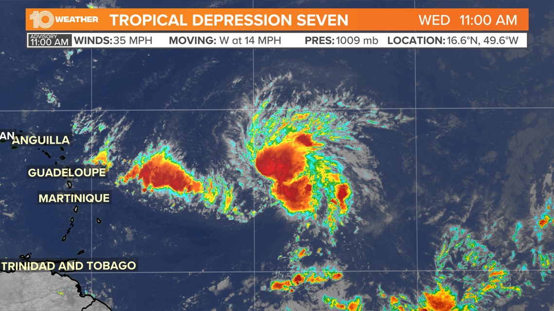
Invest 96-L has been upgraded to Tropical Depression Seven.
The National Hurricane Center as of 11 a.m. Wednesday has seen enough development to classify this system as a tropical depression.
That now allows the NHC to issue advisories including watches and warnings, along with a forecast track and intensity. The NHC may issue watches for portions of the Leeward Islands later today.
Currently, Tropical Depression Seven is about 800 miles east of the Leeward Islands and is moving to the west at 14 mph. Winds are sustained at 35 mph.
Gradual strengthening is forecasted for the next day or two. That would allow Tropical Depression Seven to strengthen into Tropical Storm Fiona.
The latest advisory brings Tropical Depression Seven near the Leeward Islands by Friday as a tropical storm with winds around 45 mph. The track will eventually move this system toward Puerto Rico and the Virgin Islands by the weekend.

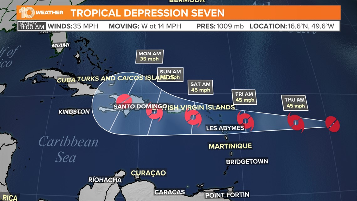
Right now, the biggest threat to the eastern Caribbean islands is heavy rainfall with some gusty winds also possible.
Beyond this week and into this weekend, the track becomes more unclear. Land interaction and other limiting factors will keep T.D. Seven from strengthening too much over the next several days. Still, Florida and the southeast coastline should keep an eye on Tropical Depression Seven as it pushes west.
Here are the 11 am AST Wednesday Key Messages for newly formed Tropical Depression #Seven. A Tropical Storm Watch could be required for portions of the Leeward Islands later today.


Advertise with the mоѕt vіѕіtеd nеwѕ ѕіtе іn Antigua!
We offer fully customizable and flexible digital marketing packages.
Contact us at [email protected]


