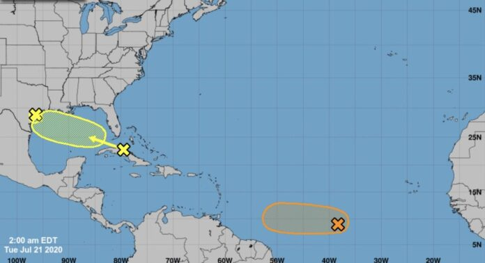
Tropical Storm Gonzalo is predicted to become a hurricane by Thursday and pass to the south of Barbados on Saturday morning.
The Barbados Meteorological Services listed the 11 a.m. position on Wednesday July 22 at 9.9N 43.6W or about 1 770 km (1 100 miles) to the east of Barbados.
The system is moving towards the west at 14 mph or 22 km/h and the forward speed of that motion is expected to increase during the next few days.
Maximum sustained winds have increased to near 50mph or 85km/h.
Gonzalo is a small tropical cyclone, with storm-force winds extending outward up to 25 miles (35 km) from the centre.
The system became better defined within the past few hours and this is evident by the improvement in the banding to the north and west and visible satellite imagery is indicating a hint of an eye developing.
If this trend continues, there could be a rapid intensification trend this afternoon, but due to the small nature of the storm, these fluctuations in intensity – up or down – are highly likely. As a result, Gonzalo could become a category one hurricane within the next 12 to 24 hours.
A tropical storm watch may be issued for Barbados sometime on Wednesday night as the system continues to track westward across the Central Atlantic. Current forecast tracks suggest that the centre should pass about 105 miles or 160 km to the south of the island on Saturday morning. (PR/SAT)
Advertise with the mоѕt vіѕіtеd nеwѕ ѕіtе іn Antigua!
We offer fully customizable and flexible digital marketing packages.
Contact us at [email protected]


As it is actually a storm if I were you I would use the image that depicts that rather than the one currently which is when it was in a depression state.
Hopefully the Windward Islands will not have too much damage. I do hope that common sense will prevail and the Liat planes that are parked at BGI. If any. Will be moved up north to Antigua to protect the assets. I do hope that bad mindedness does not come into play with PM Mottley and Gonsalves.
@Freetownson, what is your issue with Barbados. That would not be the first storm that passed through this region, with plenty of planes parked at BGI.
Sometownson you don’t have to show your colors Barbados never had to beg Antigua for anything don’t think bajans don’t know how you guys feel about them but the feeling is mutual hope you haven’t forgotten about Stanford and who helped I’m keeping my fingers crossed and hopping Liat get going again for all those unemployed people around the Caribbean.
That storm would be dropping some good water here on Saturday and Sunday into Monday.Some places could see as much as 8 inches of rain.I am looking forward to those rains.Cannot wait.
@ Foxy, no issue with Barbados. I was just making a point that a storm is approaching the Windward Islands. Under normal protocol. Assets such as aircraft would be relocated to territories that are not being affected by the incoming storm. What better place than VCBIA. Knowing the destructive forces that hurricanes can have on life and property. Just wanted to draw attention to the kerfufle that is brewing between GOAB, St. Vincent and the Barbados governments about Liat primary assets. The aircrafts. If some are parked at BGI. They need to be moved. Prevention is better than cure.
Comments are closed.