


Tropical Storm Fiona Advisory 11:

Fiona a Little Stronger. Heavy Rains and Tropical Storm Conditions Continue Across Portions of the Northern Leeward Islands.
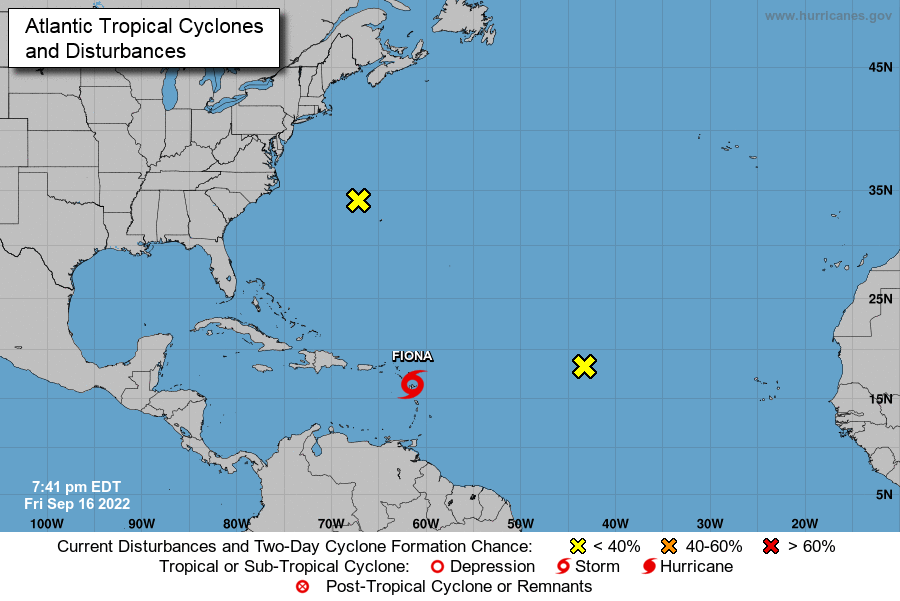
At 1100 PM AST (0300 UTC), the center of Tropical Storm Fiona was located near latitude 16.6 North, longitude 62.2 West.

Fiona is moving toward the west near 14 mph (22 km/h). A westward to west-northwestward motion with a decrease in forward speed is expected through Sunday night. A turn toward the northwest is forecast on Monday.

On the forecast track, the center of Fiona is expected to move near or just south of the Virgin Islands and Puerto Rico Saturday into Sunday, and approach the southern or eastern coast of the Dominican Republic Sunday afternoon.
Fiona is forecast to move across the Dominican Republic Sunday night and Monday.

Data from an Air Force Hurricane Hunter aircraft indicate that the maximum sustained winds have increased to near 60 mph (95 km/h) with higher gusts.
Gradual strengthening is forecast, and Fiona could be near hurricane strength when it reaches the Dominican Republic on Sunday.

Tropical-storm-force winds extend outward up to 140 miles (220 km) from the center. A wind gust of 44 mph (70 km/h) was recently reported at VC Bird International Airport in Antigua.
The estimated minimum central pressure is 1002 mb (29.59 inches).
Tropical storm conditions will continue across portions of the Leeward Islands within the warning area through Saturday afternoon.
Tropical storm conditions will spread westward to the U.S. and British Virgin Islands Saturday morning, and across Puerto Rico Saturday afternoon and Saturday night, and across portions of the Dominican Republic early Sunday.
Tropical storm conditions are possible on Dominica during the next several hours and across the watch area in the Dominican Republic beginning Sunday afternoon.
Advertise with the mоѕt vіѕіtеd nеwѕ ѕіtе іn Antigua!
We offer fully customizable and flexible digital marketing packages.
Contact us at [email protected]


This is why we need to look about our surface water- wells and dams etc . During hurricane season or any bad weather for a matter of fact the sea can be churned up and no desalination can tAke please.
Dams filling up , lots of surface water soon becomes available. So the government water crisis is over for now. The farmers will be happy for now. The home owners cisterns are all filling up
Comments are closed.