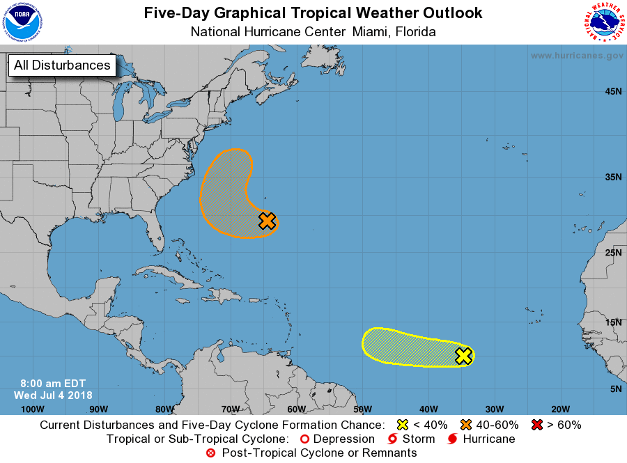
The National Hurricane Centre is watching a small area of low pressure associated with a tropical wave is located over the far eastern tropical Atlantic Ocean, producing a concentrated area of showers several hundred miles west-southwest of the Cabo Verde Islands. Some additional development of this system is possible during the next few days while the low moves westward. Upper-level winds are expected to become less conducive for development by this weekend when the system approaches the Lesser Antilles.
Elsewhere, an area of disorganized showers and thunderstorms associated with a trough of low pressure located over the Atlantic Ocean within a few hundred miles to the south of Bermuda. Environmental conditions appear conducive for some development of this system, and a tropical depression could form before the end of the week while the system moves west-northwestward and then northward between Bermuda and the east coast of the United States. The system is then forecast to interact with a frontal system on Sunday, which would limit any additional development.
Source (NOAA NWS NHC)

Advertise with the mоѕt vіѕіtеd nеwѕ ѕіtе іn Antigua!
We offer fully customizable and flexible digital marketing packages.
Contact us at [email protected]


