


A light magnitude 2.3 earthquake hit Antigua & Barbuda: near Les Abymes shortly after midnight, on Tuesday, May 21, 2024 at 12.01 am local time (America/Antigua GMT -4). The quake had a very shallow depth of 15.6 km (10 mi) and was not felt (or at least not reported so).

Weak magnitude 2.3 earthquake at 16 km depth
21 May 13:07 UTC: First to report: RENASS after 9 hours.

I didn’t feel it
I felt this quake

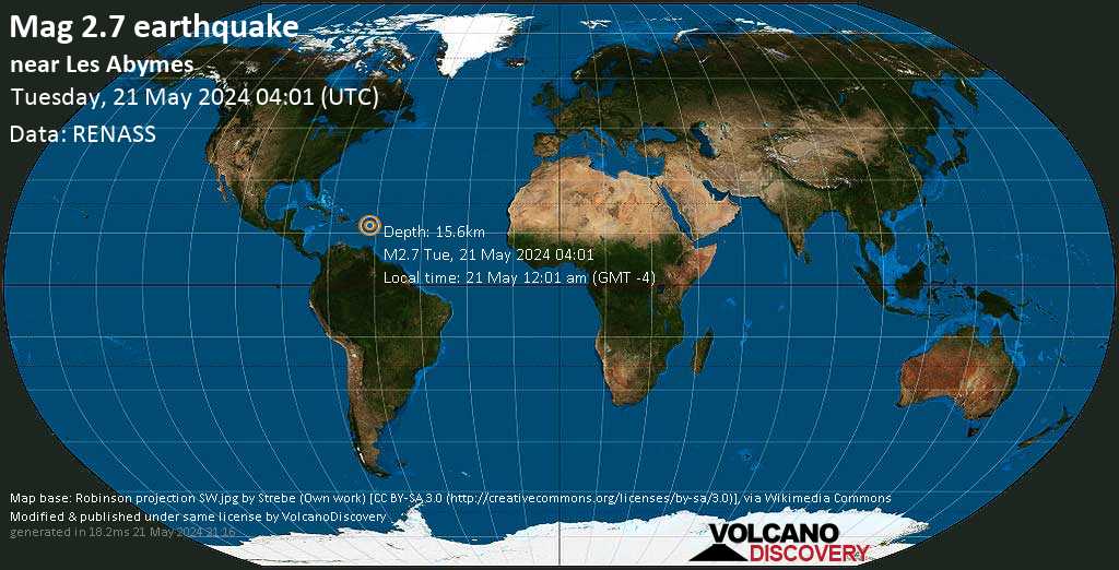
EARTHQUAKE DETAILS
| Date & time | May 21, 2024 04:01:38 UTC – 1 day 8 hours ago |
| Local time at epicenter | Tuesday, May 21, 2024, at 12:01 am (America/Antigua GMT -4) |
| Status | Confirmed (manually revised) |
| Magnitude | 2.3 |
| Depth | 15.6 km |
| Epicenter latitude / longitude | 16.8163°N / 61.6688°W |
| Seismic antipode | 16.8163°S / 118.3312°E |
| Shaking intensity | II Very weak shaking |
| Felt | 0 reports |
| Primary data source | RENASS (Réseau National de Surveillance Sismique (RéNaSS)) |
| Nearest volcano | Soufriere Hills (55 km / 34 mi) |
| Estimated seismic energy released | 1.8 x 10⁸ joules (49.4 kilowatt hours) | about seismic energy |
The closest larger town near the epicenter is Freetown, a town with 623 inhabitants in Antigua and Barbuda, in 26 km (16 mi) distance to the north, but it is unlikely that the quake was felt there.
DISTANCE | PLACE | MAX. SHAKING INTENSITY(*) | REGION | COUNTRY |
|---|---|---|---|---|
| 26 km (16 mi)N of epicenter | Freetown(pop: 623) | I: Not felt | Parish of Saint Philip | |
| 26 km (16 mi)NW of epicenter | Falmouth(pop: 619) | I: Not felt | Parish of Saint Paul | |
| 31 km (19 mi)NW of epicenter | All Saints(pop: 2,530) | I: Not felt | Parish of Saint Peter | |
| 39 km (24 mi)NW of epicenter | St John’s(pop: 24,200) | I: Not felt | Parish of Saint John | |
| 42 km (26 mi)SE of epicenter | Anse-Bertrand(pop: 5,150) | I: Not felt | Guadeloupe, Guadeloupe | |
| 52 km (33 mi)S of epicenter | Petit-Canal(pop: 8,550) | I: Not felt | Guadeloupe, Guadeloupe | |
| 54 km (33 mi)S of epicenter | Sainte-Rose(pop: 20,200) | I: Not felt | Guadeloupe, Guadeloupe | |
| 58 km (36 mi)W of epicenter | Brades(pop: 1000) | I: Not felt | Parish of Saint Peter | |
| 61 km (38 mi)S of epicenter | Le Lamentin(pop: 14,900) | : Not felt | Guadeloupe, Guadeloupe | |
| 62 km (38 mi)S of epicenter | Baie-Mahault(pop: 30,600) | : Not felt | Guadeloupe, Guadeloupe | |
| 63 km (39 mi)S of epicenter | Les Abymes(pop: 53,500) | : Not felt | Guadeloupe, Guadeloupe | |
| 64 km (40 mi)SE of epicenter | Le Moule(pop: 22,700) | : Not felt | Guadeloupe, Guadeloupe | |
| 66 km (41 mi)S of epicenter | Pointe-à-Pitre(pop: 15,200) | : Not felt | Guadeloupe, Guadeloupe | |
| 66 km (41 mi)S of epicenter | Pointe-Noire(pop: 7,750) | : Not felt | Guadeloupe, Guadeloupe | |
| 70 km (43 mi)S of epicenter | Petit-Bourg(pop: 25,000) | : Not felt | Guadeloupe, Guadeloupe | |
| 70 km (44 mi)S of epicenter | Le Gosier(pop: 28,700) | : Not felt | Guadeloupe, Guadeloupe | |
| 73 km (45 mi)SE of epicenter | Sainte-Anne(pop: 22,900) | : Not felt | Guadeloupe, Guadeloupe | |
| 76 km (47 mi)SE of epicenter | Saint-François(pop: 12,700) | : Not felt | Guadeloupe, Guadeloupe | |
| 77 km (48 mi)S of epicenter | Bouillante(pop: 7,540) | : Not felt | Guadeloupe, Guadeloupe | |
| 85 km (53 mi)SE of epicenter | Beauséjour(pop: 1,720) | : Not felt | Guadeloupe, Guadeloupe | |
| 87 km (54 mi)S of epicenter | Capesterre-Belle-Eau(pop: 19,800) | : Not felt | Guadeloupe, Guadeloupe | |
| 88 km (55 mi)S of epicenter | Saint-Claude(pop: 10,100) | : Not felt | Guadeloupe, Guadeloupe | |
| 91 km (57 mi)S of epicenter | Basse Terre(pop: 11,500) | : Not felt | Guadeloupe, Guadeloupe | |
| 93 km (58 mi)N of epicenter | Codrington(pop: 1,330) | : Not felt | Barbuda | |
| 105 km (65 mi)W of epicenter | Fig Tree(pop: 2,920) | : Not felt | Saint John Figtree | |
| 108 km (67 mi)S of epicenter | Petites Anses(pop: 1,310) | : Not felt | Guadeloupe, Guadeloupe | |
| 110 km (69 mi)S of epicenter | Grand-Bourg(pop: 5,870) | : Not felt | Guadeloupe, Guadeloupe | |
| 124 km (77 mi)NW of epicenter | Basseterre(pop: 12,900) | : Not felt | Saint George Basseterre | |
| 139 km (86 mi)S of epicenter | Portsmouth(pop: 3,630) | : Not felt | ||
| 140 km (87 mi)NW of epicenter | Saint Paul’s(pop: 2,460) | : Not felt | Saint Paul Capesterre | |
| 148 km (92 mi)S of epicenter | Marigot(pop: 2,670) | : Not felt | Saint Andrew | |
| 150 km (93 mi)S of epicenter | Colihaut(pop: 890) | : Not felt | Saint Peter | |
| 158 km (98 mi)NW of epicenter | Orange Town(pop: 1,100) | : Not felt | Sint Eustatius | |
| 174 km (108 mi)NW of epicenter | Gustavia(pop: 5,990) | : Not felt | ||
| 199 km (123 mi)NW of epicenter | Philipsburg(pop: 1,400) | : Not felt |
Notes:
(*) Shaking intensity according to the Modified Mercalli Intensity Scale (MMI) and estimated using seismic models.

Advertise with the mоѕt vіѕіtеd nеwѕ ѕіtе іn Antigua!
We offer fully customizable and flexible digital marketing packages.
Contact us at [email protected]


