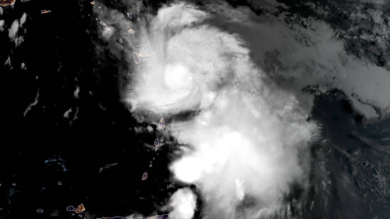
Antigua and Barbuda are under the imminent threat of Hurricane Tammy. As of 5 am, Hurricane Tammy’s center was situated at latitude 15.2 North and longitude 60.4 West.
It is steadily moving in a northwesterly direction at a speed of 9 mph (15 km/h) and is expected to maintain this trajectory through the night.
The weather forecast predicts that on Sunday, the storm will veer north-northwest, followed by a turn towards the north on Monday.
The Leeward Islands are expected to bear the brunt of the hurricane, with Tammy’s center passing near or over parts of these islands until early Sunday. By Sunday afternoon, it is anticipated to move north of the northern Leeward Islands.
With maximum sustained winds hovering around 80 mph (130 km/h) and possible fluctuations in intensity over the next few days, Tammy is expected to remain a hurricane while interacting with the Leeward Islands.
The hurricane-force winds extend outward up to 25 miles (35 km) from its center, with tropical-storm-force winds reaching up to 125 miles (205 km). The estimated minimum central pressure is 991 mb (29.27 inches).
Hazardous conditions are set to escalate within the hurricane warning area later in the morning and extend northward across the Leeward Islands throughout the day and night.
The tropical storm warning areas will also experience tropical storm conditions during this period, while hurricane conditions are possible in the hurricane watch areas.
The British Virgin Islands should brace for tropical storm conditions on the upcoming night and Sunday, and Martinique may experience similar conditions today.
Additionally, Hurricane Tammy is projected to unleash substantial rainfall, with the Leeward Islands expecting 4 to 8 inches and maximum amounts of up to 12 inches.
Portions of the Windward Islands might receive 2 to 4 inches, with a maximum of 6 inches, while the British and U.S. Virgin Islands into eastern Puerto Rico could witness 1 to 2 inches, with a maximum of 4 inches.
These rainfall levels pose a significant risk of flash floods, urban flooding, and potential mudslides, particularly in elevated terrains.
A storm surge, accompanied by large and dangerous coastal waves, could raise water levels by 1 to 3 feet above normal tide levels as Hurricane Tammy crosses the Leeward Islands. Moreover, Tammy’s swells are likely to create life-threatening surf and rip currents, affecting various areas of the Lesser Antilles in the coming days.
For comprehensive information and guidance, it is essential to consult local weather authorities to stay updated on this evolving situation.
Advertise with the mоѕt vіѕіtеd nеwѕ ѕіtе іn Antigua!
We offer fully customizable and flexible digital marketing packages.
Contact us at [email protected]


