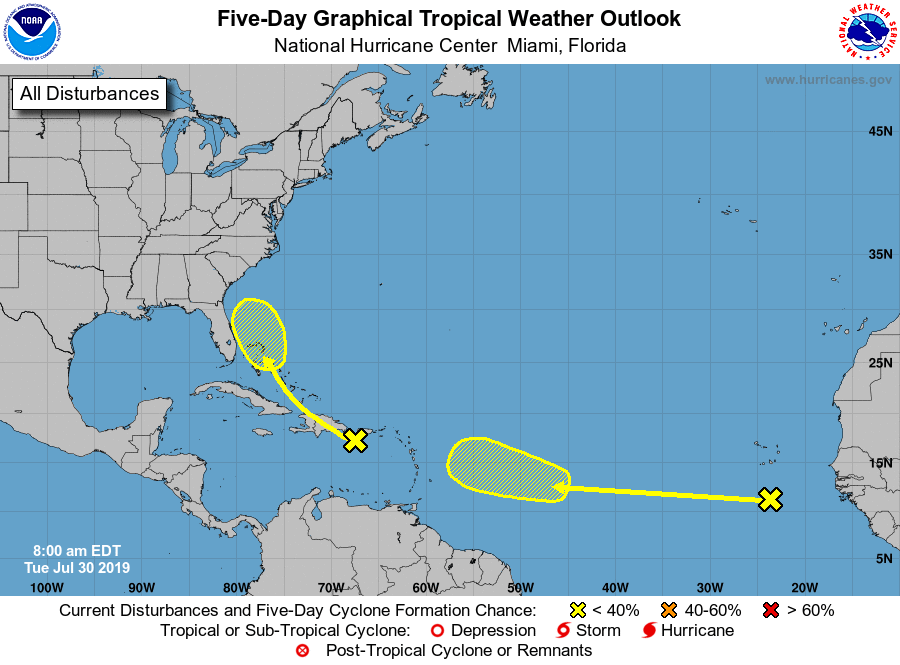
Officials are monitoring two disturbances across the Atlantic Basin, particularly the one just off of Africa.
Both have slight chances of developing into a Tropical Cyclone at this time.
A tropical wave located over the northeastern Caribbean Sea is
producing disorganized showers and thunderstorms. This system is
expected to move west-northwestward with no significant development
during the next few days, producing locally heavy rainfall over
Puerto Rico and the Virgin Islands, Hispaniola, and portions of the
southeastern Bahamas. Conditions could become marginally conducive
for development by the weekend when the disturbance moves near
Florida and northwestern Bahamas.
* Formation chance through 48 hours...low...near 0 percent.
* Formation chance through 5 days...low...10 percent.

A tropical wave accompanied by a broad low pressure system
continues to produce a large area of cloudiness and disorganized
shower activity over the far eastern tropical Atlantic, a few
hundred miles south of the Cabo Verde Islands. No significant
development of this system is expected for the next few days while
the it moves westward at 15 to 20 mph.  Upper-level winds could
become more conducive for development by the weekend while the wave
continues westward across the central Atlantic.
* Formation chance through 48 hours...low...near 0 percent.
* Formation chance through 5 days...low...20 percent.
Advertise with the mоѕt vіѕіtеd nеwѕ ѕіtе іn Antigua!
We offer fully customizable and flexible digital marketing packages.
Contact us at [email protected]


Lord have mercy on us here in the Caribbean Islands especially Antigua and Barbuda. If it is Your will that we should experience any strong wind, please put Your shield of protection on our lives and properties in the Name of Your Son Jesus Christ. Amen.
Amen sister
We need the rain but not the wind.
That nar tap Carnival!!!
Lol “could a harry cane are tarnaydoe….a fete u gah fete tonight???
Thank God for the rain.
Comments are closed.