Antigua & Barbuda Advances Sustainable Land Management with Capacity Building Workshop using Google Earth Engine Tools Under CSIDS SOILCARE Phase 1 Project by Brent Simon and Carol-Faye Bynoe-George
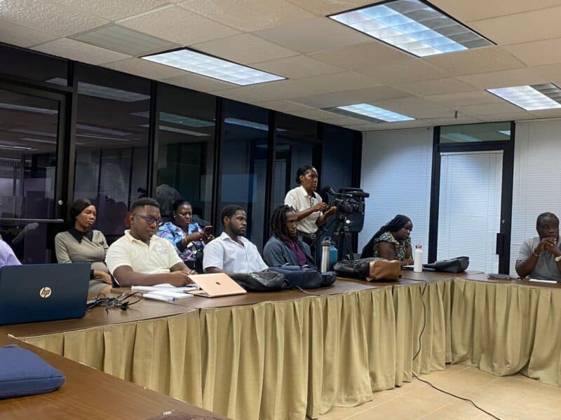
This week, technicians within the Ministry of Agriculture, Lands, Fisheries and the Blue Economy participated in a training program on Land Degradation Neutrality (LDN) at the Inland Revenue Training Room. Conducted under the CSIDS SOILCARE Phase 1 project, an initiative led by the Partnership Initiative for Sustainable Land Management (PISLM), the training aimed to build local capacity in sustainable land management practices.
The sessions were facilitated by Dr. Cesar Luis Garcia a seasoned environmental scientist with extensive expertise in sustainable land management. Dr. Garcia has worked with global organizations such as FAO and UNCCD to advance LDN targets worldwide. Using Google Earth Engine (GEE), participants received hands-on training in leveraging satellite imagery and data-processing tools to monitor and combat land degradation effectively.
The training commenced with opening remarks from Ms. Simone Dias, with a virtual presentation from Mr. Trevor Thompson, Project Manager at PISLM, followed by remarks from Mr. Gregory Bailey, Director of Agriculture who both echoed on the unique challenges faced by small island developing states (SIDS), noting the inadequacy of traditional methodologies and the need for new, high-resolution datasets that incorporate satellite information and local knowledge for better decision-making.
Dr. Garcia then began the technical sessions, focusing on how GEE’s satellite imagery and data-processing tools enable real-time insights into key degradation indicators like vegetation cover, soil health, and land productivity. Achieving Land Degradation Neutrality (LDN) is critical for healthy ecosystems and aligns with Sustainable Development Goal 15.3. Through this training, Dr. Garcia demonstrated how GEE can be a transformative tool for monitoring land degradation. By analyzing satellite data, technicians can assess the effects of conservation practices, prioritize areas needing restoration, and support data-driven policy decisions.
The interactive sessions have fully engaged participants, providing them with practical skills to apply GEE in their work. This training empowers local experts to manage land resources more effectively, bolstering Antigua & Barbuda’s capacity for sustainable land management. With these new capabilities, government ministries can independently monitor, assess, and address land degradation issues across the island.
By investing in local expertise, Antigua and Barbuda is taking proactive steps toward environmental resilience. The CSIDS SOILCARE Phase 1 project helps to propel the message of the importance of empowering local professionals with advanced geospatial tools, accelerating progress toward national and regional LDN goals.
This initiative reinforces Nation’s commitment to preserving its natural resources and achieving global sustainability targets. With practical trainings, cutting-edge tools and data coupled with skilled local experts, the twin island state is well-positioned to lead the Caribbean in sustainable land management and environmental stewardship.
Advertise with the mоѕt vіѕіtеd nеwѕ ѕіtе іn Antigua!
We offer fully customizable and flexible digital marketing packages.
Contact us at [email protected]


