


CLICK HERE TO JOIN OUR WHAT’S APP GROUP

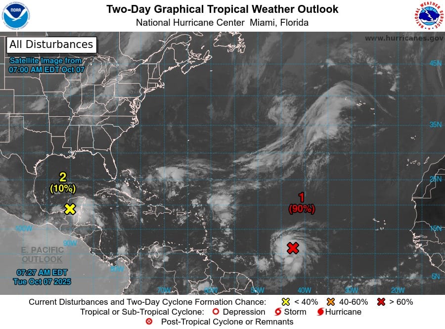
An area of low pressure located more than 1,000 miles east of the Windward Islands is showing strong signs of development and could become a tropical depression later today, according to forecasters.
The system, currently identified as Invest AL95, has been steadily organizing as it moves west-northwest across the central tropical Atlantic. Meteorologists say it has a 90% chance of formation within the next 48 hours.
CLICK HERE TO JOIN OUR WHAT’S APP GROUP

If the system continues to strengthen, it could pass near or north of the northern Leeward Islands between Thursday and Friday, potentially bringing heavy rain, gusty winds, and rough seas to parts of the northeastern Caribbean.
While it is too early to determine the exact track or intensity, residents across Antigua and Barbuda, Saint Kitts and Nevis, Anguilla, and the British Virgin Islands are being urged to stay alert and monitor official weather updates.

Regional meteorological offices and disaster management agencies are expected to issue further advisories as the system develops.
CLICK HERE TO JOIN OUR WHAT’S APP GROUP

CLICK HERE TO JOIN OUR WHAT’S APP GROUP
CLICK HERE TO JOIN OUR WHAT’S APP GROUP
CLICK HERE TO JOIN OUR WHAT’S APP GROUP
CLICK HERE TO JOIN OUR WHAT’S APP GROUP
CLICK HERE TO JOIN OUR WHAT’S APP GROUP
CLICK HERE TO JOIN OUR WHAT’S APP GROUP
CLICK HERE TO JOIN OUR WHAT’S APP GROUP
CLICK HERE TO JOIN OUR WHAT’S APP GROUP
CLICK HERE TO JOIN OUR WHAT’S APP GROUP
CLICK HERE TO JOIN OUR WHAT’S APP GROUP
CLICK HERE TO JOIN OUR WHAT’S APP GROUP
Advertise with the mоѕt vіѕіtеd nеwѕ ѕіtе іn Antigua!
We offer fully customizable and flexible digital marketing packages.
Contact us at [email protected]


