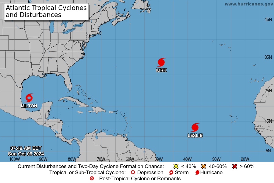
The current weather systems in the Atlantic are not expected to impact the Leeward and Windward Islands, however officials warns that the Hurricane Season remains active and a storm can strike at any time.
Elsewhere, At 500 AM AST (0900 UTC), the center of Hurricane Kirk was located near latitude 33.5 North, longitude 49.0 West. Kirk is moving toward the north-northeast near 23 mph (37 km/h).
An acceleration toward the northeast and east-northeast is expected over the next few days while Kirk moves across the northeastern Atlantic.

Maximum sustained winds are near 105 mph (165 km/h) with higher gusts. Although weakening is expected through midweek, Kirk will remain a large hurricane for the next next day or so before transitioning to an extratropical cyclone by early Tuesday.
Hurricane-force winds extend outward up to 70 miles (110 km) from the center and tropical-storm-force winds extend outward up to 230
miles (370 km).
The estimated minimum central pressure is 957 mb (28.26 inches).
HAZARDS AFFECTING LAND
———————-
SURF: Swells generated by Kirk are affecting the Leeward Islands, Bermuda, the Greater Antilles, the Bahamas, and the east coast of
the United States. These swells will continue spreading northward along the east coast of the United States and Atlantic Canada today,
and to the Azores on Monday.
These swells are likely to cause life-threatening surf and rip current conditions. Please consult products from your local weather office.
Advertise with the mоѕt vіѕіtеd nеwѕ ѕіtе іn Antigua!
We offer fully customizable and flexible digital marketing packages.
Contact us at [email protected]


