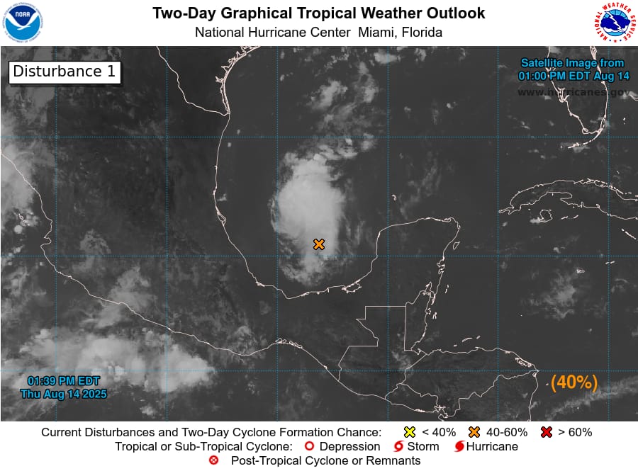
Showers and thunderstorms have intensified around an area of low pressure, designated Invest #AL98, in the Bay of Campeche. According to the National Hurricane Center, the system is moving toward the coast of northeastern Mexico and southern Texas and could develop into a tropical depression before making landfall late Friday.
Forecasters say the disturbance has a medium chance of formation over the next day or two. Even if it does not strengthen further, the system is expected to bring heavy rainfall to portions of northeastern Mexico and southern Texas through the weekend.
An Air Force Reserve Hurricane Hunter aircraft is currently investigating the storm to gather more data on its structure and potential for intensification.
Residents in the affected areas are urged to monitor official updates and prepare for possible flooding.
More information is available at hurricanes.gov.
Advertise with the mоѕt vіѕіtеd nеwѕ ѕіtе іn Antigua!
We offer fully customizable and flexible digital marketing packages.
Contact us at [email protected]


