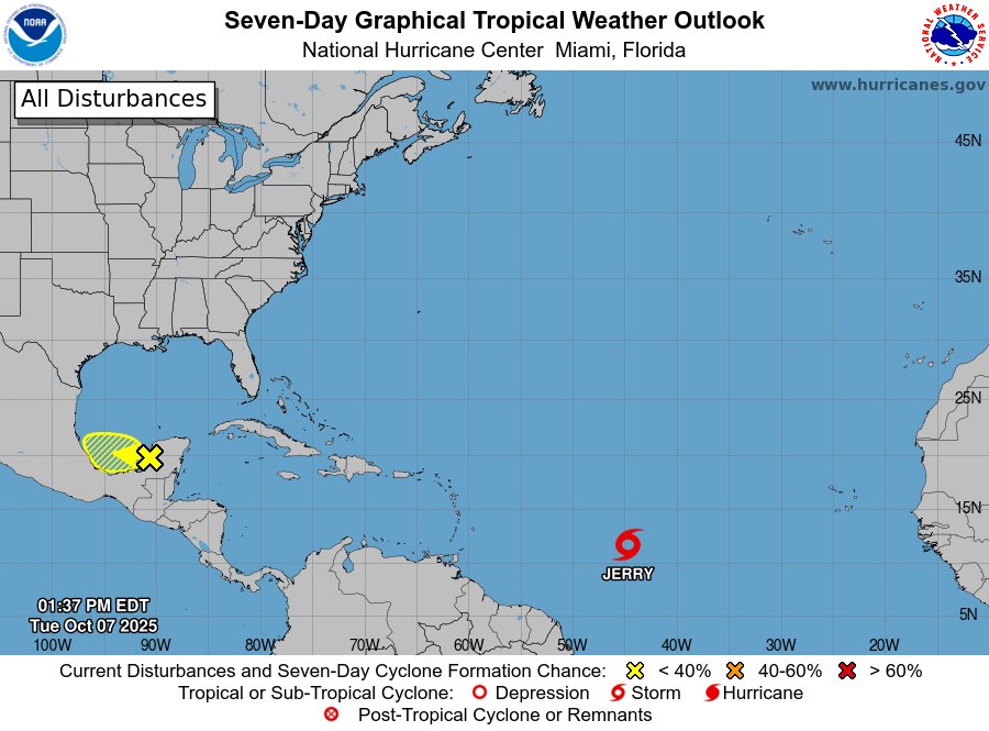
Tropical Storm Jerry continued moving quickly west-northwest early Wednesday morning as a NOAA Hurricane Hunter aircraft began investigating the system, the U.S. National Hurricane Center said.
At 8 a.m. AST, the storm’s center was located near latitude 13.3 North and longitude 51.6 West, or about 835 miles (1,345 kilometers) east-southeast of the northern Leeward Islands. Jerry was moving at 23 mph (37 km/h) with maximum sustained winds near 50 mph (85 km/h). The minimum central pressure was 1003 millibars.
A Tropical Storm Watch remains in effect for:
- Antigua, Barbuda, and Anguilla
- St. Kitts, Nevis, and Montserrat
- St. Barthelemy and St. Martin
- Sint Maarten
- Saba and St. Eustatius
- Guadeloupe and adjacent islands
The National Hurricane Center said the storm is expected to continue on its current path before slowing down and turning north-northwest by Friday. On its projected track, the system’s core will pass near or north of the northern Leeward Islands late Thursday into Friday.
Forecasters expect Jerry to strengthen into a hurricane on Thursday. Tropical-storm-force winds currently extend up to 125 miles (205 kilometers) from the center.
The NHC warned that tropical storm conditions are possible in the watch areas beginning late Thursday. Rainfall totals of 2 to 4 inches could cause flash flooding, especially in elevated areas.
Swells generated by Jerry are expected to reach the Leeward and Windward Islands on Thursday and spread westward toward the Greater Antilles on Friday. These swells may cause life-threatening surf and rip current conditions, forecasters said.
Residents are urged to monitor updates from their national meteorological services and follow official guidance as Jerry approaches.
The next full advisory will be issued at 11 a.m. AST.
Advertise with the mоѕt vіѕіtеd nеwѕ ѕіtе іn Antigua!
We offer fully customizable and flexible digital marketing packages.
Contact us at [email protected]


