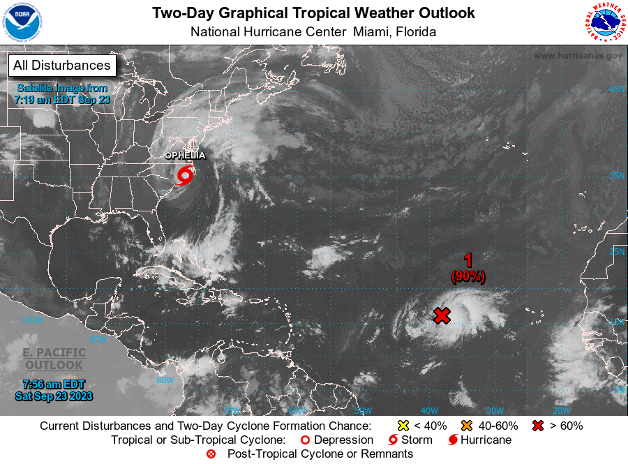
NHC – An area of low pressure situated several hundred miles west of the Cabo Verde Islands in the Central Tropical Atlantic is exhibiting signs of improved organization.
Over the past few hours, showers and thunderstorms associated with this system have intensified.
The arrival of satellite-derived wind data later this morning is expected to reveal whether a well-defined surface circulation has formed.
Further development is anticipated, and it’s highly probable that a tropical depression will materialize today.
The system is projected to maintain a westward trajectory at 10 to 15 mph in the coming days, potentially shifting to a west-northwestward or northwestward path starting Tuesday.
For additional updates on this weather system, consult High Seas Forecasts issued by the National Weather Service.
The likelihood of formation within 48 hours is high at 90 percent, and the probability of development over the next 7 days is high, near 100 percent.
CLICK HERE TO JOIN OUR WHATSAPP GROUP
CLICK HERE TO JOIN OUR WHATSAPP GROUP
CLICK HERE TO JOIN OUR WHATSAPP GROUP
CLICK HERE TO JOIN OUR WHATSAPP GROUP
Advertise with the mоѕt vіѕіtеd nеwѕ ѕіtе іn Antigua!
We offer fully customizable and flexible digital marketing packages.
Contact us at [email protected]


