


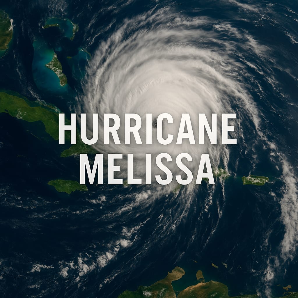


Hurricane Melissa has intensified into a catastrophic “super” Category 5 storm with sustained winds of 175 mph (280 km/h) as it bears down on Jamaica, threatening to unleash life-threatening winds, floods, and storm surge across the island.

At 11 a.m. Monday, the hurricane’s eye was located about 145 miles (230 km) southwest of Kingston, moving slowly west-northwest, according to the U.S. National Hurricane Center (NHC). Forecasters warn that Melissa appears to be making its long-feared turn toward Jamaica, setting up a possible direct strike tonight or early Tuesday.
Officials say the storm’s extreme strength and slow movement make it especially dangerous. Melissa’s outer bands have already begun lashing southern parishes with heavy rain and tropical-storm-force winds, with conditions expected to deteriorate rapidly through the evening.

“This is a serious, life-threatening situation,” meteorologists cautioned, urging residents to complete emergency preparations immediately and move to higher ground if necessary.

Hurricane warnings are in effect for all of Jamaica and parts of eastern Cuba. Shelters have been activated across the island, and emergency services remain on standby until it is safe to respond.
Satellite imagery shows a sharply defined eye surrounded by deep convection — a classic hallmark of a storm at peak intensity. While some weakening is possible after landfall, forecasters say Melissa could maintain Category 5 strength for several more hours.

Residents are urged to stay indoors, avoid low-lying areas, and keep communication devices charged amid likely power outages.
Melissa is the strongest hurricane to threaten Jamaica in years, capping what meteorologists describe as one of the most active Atlantic hurricane seasons on record.

Advertise with the mоѕt vіѕіtеd nеwѕ ѕіtе іn Antigua!
We offer fully customizable and flexible digital marketing packages.
Contact us at [email protected]


Jamaica is going to be absolutely hammered when this thing finally comes ashore and the aftermath will be horrendous for those who will desperately need help. I hope that the only highway that connects Kingston to the airport doesn’t get completely destroyed by the storm surge; some areas of that road look like it is barely six feet above sea level.
In the TCI, this won’t be anything near its current intensity by time it comes close to us on Wednesday but our preparations are complete and I’m ready to assist my neighbors if things turn bad here.
Comments are closed.