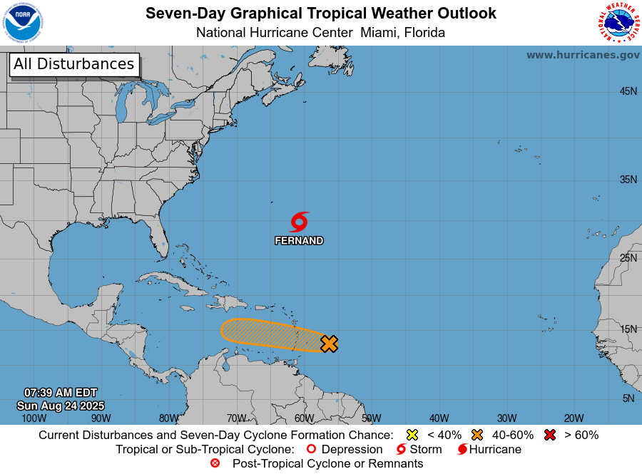
8a EDT Aug 24- We are watching a tropical wave near the Windward Islands with a medium (40%) chance of becoming a tropical depression over the next couple of days. It is likely to bring locally heavy rains & gusty winds through Mon for parts of the Windward/Leeward Islands #AL99
ABNT20 KNHC 241139
TWOAT
Tropical Weather Outlook
NWS National Hurricane Center Miami FL
800 AM EDT Sun Aug 24 2025
For the North Atlantic…Caribbean Sea and the Gulf of America:
East of the Windward Islands (AL99):
Showers and thunderstorms associated with a tropical wave located about 200 miles east of the Windward Islands have increased since yesterday. However, the wave does not appear to have a surface circulation.
This system could still become a tropical depression during the next day or two while it moves quickly westward at about 20 to 25 mph, passing through the Windward and Leeward Islands later today and early Monday.
Regardless of development, locally heavy rainfall and gusty winds are likely across portions of the Windward and Leeward Islands today and Monday.
The system is expected to reach the central Caribbean Sea on Tuesday, where conditions are forecast to become less favorable for additional development.
An Air Force reconnaissance aircraft is scheduled to investigate the system this afternoon, if necessary.
- Formation chance through 48 hours…medium…40 percent.
- Formation chance through 7 days…medium…40 percent.
Advertise with the mоѕt vіѕіtеd nеwѕ ѕіtе іn Antigua!
We offer fully customizable and flexible digital marketing packages.
Contact us at [email protected]


