CLICK HERE TO JOIN OUR WHAT’S APP GROUP
SOURCE: WEATHER CHANNEL- The National Hurricane Center is monitoring another area of interest in the Atlantic that’s following a similar path as Erin.
While Hurricane Erin is drawing most of the attention, there is another area worth watching in the Atlantic. And it’s right on Erin’s heels.
MORE: Get the latest on Erin here
The National Hurricane Center has highlighted an area of interest that looks eerily similar to how Erin was formed.
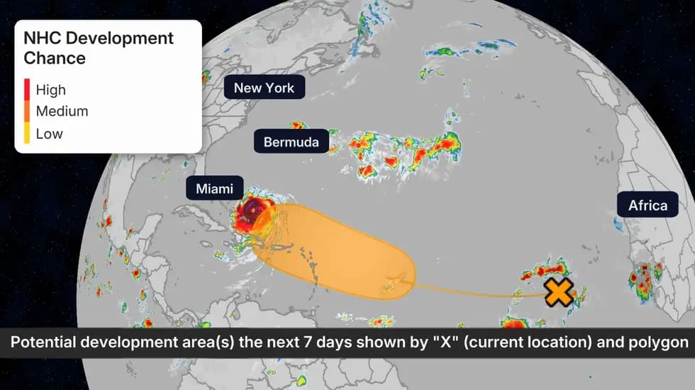
Possible NHC Development
(The possible area(s) of tropical development according to the latest National Hurricane Center outlook are shown by polygons, color-coded by the chance of development over the next seven days. An “X” indicates the location of a current disturbance.)
It’s associated with a tropical wave that has emerged off of Africa, and as it travels westward across the Atlantic, conditions are expected to become more favorable for development.
The NHC says a tropical depression could form as soon as the latter part of the week, and this system could be near the Leeward Islands as soon as Friday.
While it’s too early to know what track this storm would take if it is named beyond Friday, this one is worth watching closely. Check back often for more details, as we continue to keep a close eye on any development.
The next name on the hurricane list is Fernand.
CLICK HERE TO JOIN OUR WHAT’S APP GROUP
CLICK HERE TO JOIN OUR WHAT’S APP GROUP
CLICK HERE TO JOIN OUR WHAT’S APP GROUP
CLICK HERE TO JOIN OUR WHAT’S APP GROUP
CLICK HERE TO JOIN OUR WHAT’S APP GROUP
CLICK HERE TO JOIN OUR WHAT’S APP GROUP
CLICK HERE TO JOIN OUR WHAT’S APP GROUP
CLICK HERE TO JOIN OUR WHAT’S APP GROUP
Advertise with the mоѕt vіѕіtеd nеwѕ ѕіtе іn Antigua!
We offer fully customizable and flexible digital marketing packages.
Contact us at [email protected]


