


Mag. 2.8 quake – Caribbean Sea, 9.9 km south of Antigua Island, Antigua and Barbuda, on Friday, May 24, 2024, at 12:01 am (Antigua time) – 21 hours ago
A light magnitude 2.8 earthquake occurred in the Caribbean Sea near Antigua island, Antigua and Barbuda, shortly after midnight, on Friday, May 24, 2024 at 12.01 am local time (America/Antigua GMT -4). The quake had a very shallow depth of 17 km (11 mi) and was not felt (or at least not reported so).

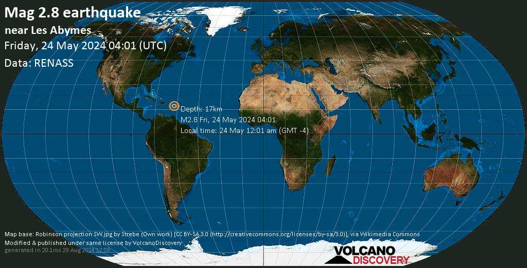
Weak magnitude 2.8 earthquake at 17 km depth
24 May 13:07 UTC: First to report: RENASS after 9 hours.
24 May 13:21: Magnitude recalculated from 2.9 to 2.8.

I didn’t feel it

I felt this quake
EARTHQUAKE DETAILS
| Date & time | May 24, 2024 04:01:01 UTC – 21 hours ago |
| Local time at epicenter | Friday, May 24, 2024, at 12:01 am (America/Antigua GMT -4) |
| Status | Confirmed (manually revised) |
| Magnitude | 2.8 |
| Depth | 17 km |
| Epicenter latitude / longitude | 16.9893°N / 61.7769°W |
| Seismic antipode | 16.9893°S / 118.2231°E |
| Shaking intensity | II Very weak shaking |
| Felt | 0 reports |
| Primary data source | RENASS (Réseau National de Surveillance Sismique (RéNaSS)) |
| Nearest volcano | Soufriere Hills (52 km / 32 mi) |
| Estimated seismic energy released | 1 x 10⁹ joules (278 kilowatt hours, equivalent to 0.239 tons of TNT) | about seismic energy |
NEARBY PLACES
The closest larger town where the quake might have been felt is All Saints, a town with 2,500 inhabitants in Antigua and Barbuda, in 8.8 km (5.5 mi) distance north of the epicenter. People likely experienced very weak shaking there. Several smaller towns and villages are located closer to the epicenter and might have experienced stronger shaking. In the capital of ![]() Anguilla, Valley, 193 km (120 mi) away from the epicenter, the earthquake could not be felt.
Anguilla, Valley, 193 km (120 mi) away from the epicenter, the earthquake could not be felt.
The following table shows some of the places that might have been affected (or not) by the shaking.

DISTANCE | PLACE | MAX. SHAKING INTENSITY(*) | REGION | COUNTRY |
|---|---|---|---|---|
| 4 km (3 mi)N of epicenter | Falmouth(pop: 619) | II: Very weak | Parish of Saint Paul | |
| 9 km (5 mi)N of epicenter | All Saints(pop: 2,530) | II: Very weak | Parish of Saint Peter | |
| 12 km (7 mi)N of epicenter | Parham(pop: 969) | II: Very weak | Parish of Saint Peter | |
| 13 km (8 mi)NW of epicenter | Bolands(pop: 1,660) | II: Very weak | Parish of Saint Mary | |
| 14 km (9 mi)N of epicenter | Piggotts(pop: 1,880) | II: Very weak | Parish of Saint George | |
| 16 km (10 mi)NW of epicenter | St John’s(pop: 24,200) | II: Very weak | Parish of Saint John | |
| 51 km (32 mi)SW of epicenter | Brades(pop: 1000) | I: Not felt | Parish of Saint Peter | |
| 64 km (40 mi)SE of epicenter | Anse-Bertrand(pop: 5,150) | I: Not felt | Guadeloupe, Guadeloupe | |
| 72 km (45 mi)N of epicenter | Codrington(pop: 1,330) | I: Not felt | ||
| 74 km (46 mi)S of epicenter | Sainte-Rose(pop: 20,200) | I: Not felt | Guadeloupe, Guadeloupe | |
| 75 km (46 mi)SE of epicenter | Petit-Canal(pop: 8,550) | I: Not felt | Guadeloupe, Guadeloupe | |
| 81 km (51 mi)S of epicenter | Le Lamentin(pop: 14,900) | I: Not felt | Guadeloupe, Guadeloupe | |
| 83 km (51 mi)S of epicenter | Baie-Mahault(pop: 30,600) | I: Not felt | Guadeloupe, Guadeloupe | |
| 84 km (52 mi)S of epicenter | Pointe-Noire(pop: 7,750) | I: Not felt | Guadeloupe, Guadeloupe | |
| 85 km (53 mi)S of epicenter | Les Abymes(pop: 53,500) | I: Not felt | Guadeloupe, Guadeloupe | |
| 86 km (54 mi)SE of epicenter | Le Moule(pop: 22,700) | I: Not felt | Guadeloupe, Guadeloupe | |
| 87 km (54 mi)S of epicenter | Pointe-à-Pitre(pop: 15,200) | I: Not felt | Guadeloupe, Guadeloupe | |
| 89 km (55 mi)W of epicenter | Fig Tree(pop: 2,920) | I: Not felt | Saint John Figtree | |
| 91 km (56 mi)S of epicenter | Petit-Bourg(pop: 25,000) | I: Not felt | Guadeloupe, Guadeloupe | |
| 92 km (57 mi)S of epicenter | Le Gosier(pop: 28,700) | I: Not felt | Guadeloupe, Guadeloupe | |
| 95 km (59 mi)SE of epicenter | Sainte-Anne(pop: 22,900) | I: Not felt | Guadeloupe, Guadeloupe | |
| 96 km (59 mi)S of epicenter | Bouillante(pop: 7,540) | I: Not felt | Guadeloupe, Guadeloupe | |
| 98 km (61 mi)SE of epicenter | Saint-François(pop: 12,700) | I: Not felt | Guadeloupe, Guadeloupe | |
| 106 km (66 mi)W of epicenter | Basseterre(pop: 12,900) | I: Not felt | Saint George Basseterre | |
| 107 km (66 mi)SE of epicenter | Beauséjour(pop: 1,720) | I: Not felt | Guadeloupe, Guadeloupe | |
| 107 km (67 mi)S of epicenter | Capesterre-Belle-Eau(pop: 19,800) | I: Not felt | Guadeloupe, Guadeloupe | |
| 108 km (67 mi)S of epicenter | Saint-Claude(pop: 10,100) | I: Not felt | Guadeloupe, Guadeloupe | |
| 110 km (69 mi)S of epicenter | Basse Terre(pop: 11,500) | I: Not felt | Guadeloupe, Guadeloupe | |
| 122 km (76 mi)W of epicenter | Saint Paul’s(pop: 2,460) | : Not felt | Saint Paul Capesterre | |
| 128 km (79 mi)S of epicenter | Petites Anses(pop: 1,310) | : Not felt | Guadeloupe, Guadeloupe | |
| 132 km (82 mi)S of epicenter | Grand-Bourg(pop: 5,870) | : Not felt | Guadeloupe, Guadeloupe | |
| 140 km (87 mi)NW of epicenter | Orange Town(pop: 1,100) | : Not felt | Sint Eustatius | |
| 152 km (95 mi)NW of epicenter | Gustavia(pop: 5,990) | : Not felt | ||
| 177 km (110 mi)NW of epicenter | Philipsburg(pop: 1,400) | : Not felt | ||
| 183 km (114 mi)NW of epicenter | Marigot(pop: 5,700) | : Not felt | ||
| 193 km (120 mi)NW of epicenter | Valley(pop: 2,040) | : Not felt | The Valley |
Notes:
(*) Shaking intensity according to the Modified Mercalli Intensity Scale (MMI) and estimated using seismic models.
Advertise with the mоѕt vіѕіtеd nеwѕ ѕіtе іn Antigua!
We offer fully customizable and flexible digital marketing packages.
Contact us at [email protected]


